

2019 ·
2018 ·
2017 ·
2016 ·
2015 ·
2014 ·
2013 ·
2012 ·
2011 ·
2010 ·
2009 ·
2008 ·
2007
2006 ·
2005 ·
2004 ·
2003 ·
2002 ·
2001 ·
2000 ·
1999 ·
1998 ·
1997 ·
1996 ·
1995
 · What is RSS?
GGE News - 2017
- Fall Graduate Seminar and Student Technical Conference
- Displays Highlighting GGE Research at Ottawa Macdonald-Cartier International Airport
- The Ellipsoid Crosses Here: Geodetic Plaque Unveiling at UNB's Head Hall
- GIS Newsroom Opens at UNB
- Dr. Zhang's EarthView3D Project Featured in the CFI 20th Anniversary Book
- Spring Graduate Seminar and Student Technical Conference
Fall Graduate Seminar and Student Technical Conference
 The GGE Fall 2017 Graduate Seminar and Student Technical Conference was held on Thursday and Friday, 16-17 November. The well-attended activity showcased the work of seven Ph.D. and six M.Sc.E. students making presentations of their selected topics previously submitted in formal papers. Through this event, GGE celebrated the 2017 GIS Day. Download the seminar agenda and presentation abstracts by clicking here.
Click on the thumbnail to look at photos of some of those involved with the conference.
Displays Highlighting GGE Research at Ottawa Macdonald-Cartier International Airport
![]() The 10,000-plus passengers passing daily through Ottawa's international airport are catching a glimpse of some of the ground-breaking research being performed at the University of New Brunswick's Department of Geodesy and Geomatics Engineering.
The 10,000-plus passengers passing daily through Ottawa's international airport are catching a glimpse of some of the ground-breaking research being performed at the University of New Brunswick's Department of Geodesy and Geomatics Engineering.
More ...
The Ellipsoid Crosses Here: Geodetic Plaque Unveiling at UNB's Head Hall
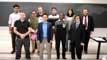
 The Department of Geodesy and Geomatics Engineering held a ceremony on Tuesday, 20 June 2017, to unveil a new plaque marking the location of the international geodetic reference ellipsoid. The plaque is affixed to the north-east wall of Head Hall, the UNB engineering building, adjacent to the A-level parking lot.
The plaque serves as a visual representation of an important mathematical surface used in positioning and navigation and welcomes visitors, students, faculty, and staff to the building.
The ellipsoid is associated with the Geodetic Reference System 1980 and positions determined using GPS, for example, are initially referenced to such an ellipsoid before the height is converted to a height above mean sea level. At Head Hall, the ellipsoid is about 22 metres above mean sea level.
After unveiling the plaque, department chair Dr. Marcelo Santos said a few words about the department's history and the importance and meaning of the plaque and associated geodetic marker.
Click on the thumbnail to look at photos taken during the ceremony.
GIS Newsroom Opens at UNB
 A new site to serve as a newsroom of GIS-related activities at UNB has been set up at http://www.unb.ca/gis/ Through this site, UNB aspires to facilitate communications among faculty, staff, and students with an interest in geospatial information systems and science. Browse the links on the home page for GIS news, events, openings, people, labs, and courses at UNB.
Dr. Zhang's EarthView3D Project Featured in the CFI 20th Anniversary Book
 Funded by the Canada Foundation for Innovation (CFI), Canada Research Chairs program, and the New Brunswick Innovation Foundation Research Technicians Initiative, Dr. Yun Zhang and his EarthView3D project team in the Department of Geodesy and Geomatics Engineering at UNB developed ground-breaking technology and a software system to generate seamless global 3D images and 3D line maps for realistic virtual reality (VR) visualization. Using a VR tool, one can travel virtually all over the world exploring the ocean floors, mountain ridges and valleys, and even one's own neighbourhood in realistic 3D without ever leaving home.
The project was selected by CFI for its 20th anniversary book, Innovation: A Desire to Make Things Better. A total of 37 outstanding research projects were selected by CFI for the book out of the thousands of projects across Canada funded by CFI since its inception.
The book, as a PDF file, may be downloaded from here.
Click on the thumbnail to see more about the book and Dr. Zhang's project.
Spring Graduate Seminar and Student Technical Conference
 The GGE Spring 2017 Graduate Seminar and Student Technical Conference was held on Thursday, 16 March. The well-attended activity showcased the work of five Ph.D., four M.Sc.E., one M.Eng, and one visiting student, making presentations of their selected topics previously documented in formal papers.
This round included high quality presentations covering topics from three of our GGE disciplines: geographic information science, geodesy, and remote sensing. The sessions were chaired by Alex Turner, a GGE M.Sc.E. student. You can download the seminar agenda, including the presentation abstracts, by clicking here.
Click on the thumbnail to get a better look.