

2019 ·
2018 ·
2017 ·
2016 ·
2015 ·
2014 ·
2013 ·
2012 ·
2011 ·
2010 ·
2009 ·
2008 ·
2007
2006 ·
2005 ·
2004 ·
2003 ·
2002 ·
2001 ·
2000 ·
1999 ·
1998 ·
1997 ·
1996 ·
1995
 · What is RSS?
GGE News - 2004
- Visit from Codelco Copper Mining Company, Chile
- Updated Dean's List for 2003-04
- 2004 Semi-Annual Graduate Seminar
- Wendy Wells Moves to University Secretariat
- Chrzanowski Becomes Life Member of APEGNB
- Ivan Detchev Wins CHA Award
- Professor Adam Chrzanowski Receives the Highest Academic Honour: Doctor Honoris Causa
- Zhang Receives NSERC I2I Award
- 2004 Geomatics Canada Scholarship Award
- Lunch With CIG
- Run for the Cure
- National Geospatial Framework for Brazil
- Dr. Y. C. Lee Memorial Scholarship
- Tenure Track Faculty Position Available at UNB
- GGE Sweeps Geomatics Atlantic Scholarships
- Fourteen GGE Undergraduates Make Dean's List
- Prof. Y.C. Lee Passes
- 12th Annual Atlantic Institute Student Research Conference
- Paul Burbidge Wins CIG John Carroll Geodesy Award
- Rodrigo Leandro Wins Award at International Conference
- Big GGE Presence at 2004 Geophysical Meeting in Montréal
- Guidance Counsellors Visit Faculty of Engineering
- Dr. Marcelo Santos visits Digby, Nova Scotia, Regional High School
- A FIG Grant for Nkwae
- Dr. Don Kim Recipient of CFI Funding
- Kim and Langley Receive Prestigious ION Burka Award
- Prof. Richard Langley Named ION Fellow
- Record Number of GGE Papers to Be Delivered at ION GNSS 2004
- New Scholarships
- Prof. Yun Zhang Finalist for Prestigious Award
- UNB GGE Meets Electronically with Institute of Navigation New England Section
- GGE Graduate Student Travis Wert's Excellent Adventure in the Canadian Arctic
- Iron Rings
- Graduating Class Banquet 2004
- 2004 Student Technical Conference
- Jason Bond Winner of NSERC Doctoral Canada Graduate Scholarship
- Minor in Geomatics
- Department of National Defence Visitor
- GGE Team Explores Complex Earth, Sun Relationship
- Timberwolves Visit GGE for Map Reading Badge
- Association of New Brunswick Land Surveyors - Charity Auction Benefits GGE
Visit from Codelco Copper Mining Company, Chile
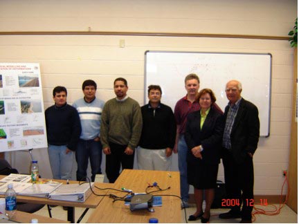 In December 2004, the Canadian Centre for Geodetic Engineering (CCGE) in cooperation with A. Chrzanowski & Associates Ltd. (ACA) offered a two-week course to a group of engineers from Codelco Norte mines in Chile. Codelco is the largest copper producer in the world. The course was titled "Curso sombre mediciones de deformacion y topicos relecionados." The course included training in the use of the ALERT system developed by CCGE and ACA for fully automated monitoring of deformations in open pit mines. The ALERT system has been installed in three Codelco Norte mines.
Click on the thumbnail image to get a better look at the participants, 36 KB.
Updated Dean's List for 2003-04

Sixteen students from Geodesy and Geomatics Engineering have made the Dean's List for 2003-2004. The dean of engineering, David Coleman, announced that the students who qualified for the list attained a sessional grade-point average of at least 3.7 or A- for the academic year. Congratulations go out to the following students:
| Fredericton, NB | Ian Church |
|---|---|
| Corey Collins | |
| Erin Grass | |
| Alexander Snyder | |
| Mactaquac, NB | George McKessock |
| Miramichi, NB | Adam Patterson |
| Waasis, NB | Beth-Anne Martin |
| Charlottetown, PE | Brett Richardson |
| Deep River, ON | Ian Cleland |
| Selkirk, ON | Matthew Webb |
| Sudbury, ON | Ryan Sequin |
| Battleford, SK | Regan Rayner |
| Vancouver, BC | James Bornemann |
| Ivan Detchev | |
| Malaysia | Suresh Jeyaverasingam |
2004 Semi-Annual Graduate Seminar
 On Monday, 22 November 2004, Geodesy and Geomatics Engineering held their Semi-Annual Graduate Seminar. There were 8 graduate students presenting on various topics including land administration, GIS, GPS, geodesy and remote sensing. Graduate student Mustafa Berber did a fabulous job organizing the seminar and chairing the sessions were graduate students Steven Dickie and Reza Ghoddousi-Fard. Following the seminar was a small reception of finger foods and refreshments. The hard work and dedication from the organizer, chairs, presenters and all who attended made it a very successful event.
Click on the thumbnail image to get a better look, 43 KB.
Wendy Wells Moves to University Secretariat
 Friday, October 22, 2004 was a day of mixed emotions for Geodesy and Geomatics Engineering. Long-time employee Wendy Wells, who was the department's administrative secretary for many years, bid farewell to GGE. Wendy's career with UNB soared to new heights when she accepted a position with the University Secretariat's Office as associate university secretary.
Wendy will be greatly missed in GGE. Her wealth of knowledge within the department is nothing less than impressive. For the office staff, her attention to detail has raised the level of expectation within themselves. For the faculty, her endless work on Research Ranking, Annual Report, Web writing, and accreditations has had a great impact on the international status of the department. For students, her teaching and editing skills have been invaluable.
We would like to express our sincere thanks and gratitude to Wendy for the many years of hard work and dedication that she has given to GGE.
Wendy, from all of us at GGE, we congratulate you on your great accomplishment and wish you every success in your new position!
Click on the thumbnail image to see some photos taken during the goodbye party, 88 KB.
Chrzanowski Becomes Life Member of APEGNB
![]() Adam Chrzanowski was awarded a Life Membership in the Association of Professional Engineers and Geoscientists of New Brunswick on 22 of October 2004.
Adam Chrzanowski was awarded a Life Membership in the Association of Professional Engineers and Geoscientists of New Brunswick on 22 of October 2004.
Ivan Detchev Wins CHA Award
 Congratulations to Ivan Detchev for winning the 2004 Canadian Hydrographic Association Student Award. The prize was awarded this summer with a cheque for Ivan for $2,000. On October 21st, Dr. David Wells presented Ivan with a framed certificate and a medallion. His name will also be inscribed on the award's perpetual plaque.
While checking the CHA Web page for information about this award, it was discovered that Matthew Bigney won the award last year. He was the award's 10th winner and the first from the University of New Brunswick.
Congratulations Ivan and belated congratulations to Matthew.
Click on the thumbnail image to get a better look, 54 KB.
Professor Adam Chrzanowski Receives the Highest Academic Honour: Doctor Honoris Causa
 On 21 October 2004, the Technical University of Mining and Metallurgy in Krakow, Poland awarded Dr. Adam Chrzanowski the highest academic title Doctor honoris causa. The honor was bestowed during the special session of the senate of the university, which was held in the historic hall of the university. The ceremony was chaired by the President of the University Prof. R. Tadeusiewicz. Among the invited guests were presidents of other Polish Universities, Ministers of Polish Government, Members of Polish Republic Parliament, Members of the Council of Polish Academy of Sciences, Professors and invited guests. During the session, Dr. Chrzanowski gave the keynote lecture on the Contribution of Polish Scientists to Geodesy in Canada.
More ...
"Professor Receives Highest Academic Honour" in the 8 March 2005 issue of UNB Perspectives.
Zhang Receives NSERC I2I Award
 Congratulations to Dr. Yun Zhang who has received an NSERC Idea to Innovation (I2I) Award for a research and development project entitled "System for automatic colour 3D satellite image generation and Web based colour 3D visualization".
The proposed project will develop a breakthrough prototype for Web-based visualization of colour 3D satellite imagery to provide users with an effective and inexpensive tool for locating, orienting, and analyzing objects or locations online. Two patent-pending technologies and one award-winning technology developed by Dr. Zhang will be integrated into the system to make it novel, innovative, and competitive.
With the funding of the I2I Award, two research assistants or post doctoral fellows will be supported to develop the system. The funding is initialized for one year, with the possibility to extend it to a second and third year.
For details on the NSERC I2I Program: http://www.nserc.gc.ca/professors_e.asp?nav=profnav&lbi=b4
2004 Geomatics Canada Scholarship Award
![]() Ivan Detchev and Tristan Goulden, both third year students, won two of the Geomatics Canada Scholarships for 2004. Funded by Natural Resources Canada and GeoConnections, and administered annually by the Canadian Institute of Geomatics (CIG), this scholarship was created to assist students enrolled in a post-secondary institution in the field of geomatics.
Ivan Detchev and Tristan Goulden, both third year students, won two of the Geomatics Canada Scholarships for 2004. Funded by Natural Resources Canada and GeoConnections, and administered annually by the Canadian Institute of Geomatics (CIG), this scholarship was created to assist students enrolled in a post-secondary institution in the field of geomatics.
In October 2002, the program was expanded to include four graduate level university scholarships of $2,500, eight undergraduate level university scholarships of $2,000, and eight college/technical institute scholarships of $1,500 awarded annually and distributed throughout the geomatics disciplines.
The CIG also presented each of the scholarship winners with a complimentary one-year student membership, which includes a subscription to Geomatica.
Lunch With CIG
 The Department and the Canadian Institute of Geomatics, New Brunswick Branch, are planning to reintroduce a brown bag lecture series this year. This lecture series fell out of favour a few years ago, but interest has recently been generated in re-establishing this "tradition." The topics for the series will span the disciplines encompassing geomatics engineering. There will be lectures aimed at improving the professional skills for students as well as seasoned veterans.
The first "lunch" in the series occurred on 16 September 2004. On offer were chats with Mark Doucette, Chair of the New Brunswick Branch of CIG, and with Randy Gillespie, National President of CIG. For the first of the series only, CIG provided pizza to entice a good crowd - 75 students turned up!!. At future events in the series, the "brown bag" will come back into use.
Topics of future lectures are:
| The job interview | |
| Employment opportunities in Geomatics, international, land surveying, hydrography | |
| Trends in Geomatics / new technologies / open source alternatives | |
| Consortium building / making money in Geomatics |
Run for the Cure
 A team from GGE made a very significant contribution to this year's "Run for the Cure" fund-raising effort. Dean Coleman said, "Congratulations to teams from the GGE Department and the Women in Engineering Society (and Friends) who participated in yesterday's (3 October 2004) "Run for the Cure" activities in Fredericton. Almost $2,800 in donations was raised between the two teams to be contributed towards breast cancer research - a tremendous accomplishment! Thanks to the students, staff, and faculty members on both teams - and to all their supporters who made donations towards the event. Your community-minded spirit and leadership is an example to us all."
More ...
National Geospatial Framework for Brazil
 The University of New Brunswick and the Canadian International Development Agency have signed a contribution agreement dealing with the implementation of a national geospatial framework in Brazil. This is a four-year long project. It's worth $7.4 million with a CIDA contribution of $2.6 million.
The project team is headed by Prof. Marcelo Santos, Department of Geodesy and Geomatics Engineering, UNB, and includes members from the Brazilian and Canadian governments and the private sector.
The Brazilian partners are the Brazilian Institute of Geography and Statistics (lead local partner), the National Institute of Colonization and Land Reform (INCRA), and state-based land reform institutes; the National Foundation for Indigenous Peoples (FUNAI); São Paulo State University; University of São Paulo; the Military Institute of Engineering; Electricity Company of Minas Gerais; Petrobras; and many other public and private sector companies. The major Canadian entities in the project are Natural Resources Canada (NRCan), Service New Brunswick (SNB), WaterMark, Optex, and Trainor Surveys.
The proposed project will transfer models and technologies in the area of national spatial reference systems, which have been developed in Canada and are recognized worldwide as leading edge systems. Canada had the unique experience in developing and implementing North America's national spatial reference system. In conjunction with the United States and Mexico, Canada coordinated the redefinition of the North American Datum from the antiquated 1927 system to a modern, satellite-based navigation and positioning system. In addition to Canada's technical expertise, the University of New Brunswick (UNB) will transfer Canadian models of collaboration and multi-stakeholder participation gained as part of the Canadian experience in developing the new spatial reference system. The many communities and industries affected by the fundamental change in the national infrastructure include the oil and gas industry, land administration entities, the forestry industry, indigenous communities, gender-related groups, and provincial-level survey agencies.
A national geospatial framework based on modern satellite technology is the underlying foundation for a system that can clearly and accurately identify and demarcate land holdings and that is an essential element required to support the long-term needs of land reform and resource development. These problems have their roots in the insecure and inequitable distribution of property rights. Physical security (including physical demarcation of property boundaries), legal recognition, and public registration are all elements of land ownership that provide citizens with the tools to actively participate in Brazil's social and economic development. Redistribution of the right to land, including recognition within the legal system of the rights people have held through land occupation, is being carried out by a number of entities and impacts millions of Brazilians.
Dr. Y. C. Lee Memorial Scholarship
 Value: $1,000.00. Number: 1. Duration: 1 year.
Conditions: Awarded to a Fredericton campus student enrolled in the Bachelor of Science in Engineering (Geomatics Engineering) degree program, who has shown special interest and promise in the study of geographic information systems.
Awarding Agency: The University on the recommendation of the Department of Geodesy and Geomatics Engineering.
Donor: Family and friends of the late Dr. Y. C. Lee, Ph.D., P.Eng., who was a faculty member of the Department of Geodesy and Geomatics Engineering.
Anyone wishing to contribute to this scholarship can contact Dominic Blakely with the Office of Development and Donor Relations at 506-458-7368, or 506-471-0735, or 506-453-5053. You can also e-mail the development office or Dominic Blakely directly.
Click on the thumbnail image to get a better look, 31 KB.
Tenure Track Faculty Position Available at UNB
 The Department of Geodesy and Geomatics Engineering (GGE) at the University of New Brunswick (UNB) (Fredericton Campus) invites applications for a tenure-track position at the Assistant Professor level effective 1 January 2005 or as soon as possible thereafter. The successful candidate shall have a solid record of research and teaching achievements in geographic information systems and, to a lesser extent, in one or more of the following geomatics fields: digital image processing, metrology, remote sensing, mapping, real-time navigation and positioning, geomatics systems integration in land and marine applications, geospatial data analysis, precise deformation measurements and analysis in support of engineering and mining applications, hydrography, and geodesy.
More.
or
More: http://gauss.gge.unb.ca/UNB_TenureTrack_ad.pdf
GGE Sweeps Geomatics Atlantic Scholarships
![]() GGE's Tristan Goulden (second year), Chris Gairns (fourth year), and Kristian Llewellyn (first year graduate) swept the three Geomatics Atlantic Scholarships available in the region. There is usually a tremendous competition for these scholarships from university and community college students in institutions in Nova Scotia, Prince Edward Island, Newfoundland and Labrador, as well as New Brunswick. So our congratulations go out to Tristan, Chris, and Kristian for winning all available scholarships, each of which is worth $1,000.
GGE's Tristan Goulden (second year), Chris Gairns (fourth year), and Kristian Llewellyn (first year graduate) swept the three Geomatics Atlantic Scholarships available in the region. There is usually a tremendous competition for these scholarships from university and community college students in institutions in Nova Scotia, Prince Edward Island, Newfoundland and Labrador, as well as New Brunswick. So our congratulations go out to Tristan, Chris, and Kristian for winning all available scholarships, each of which is worth $1,000.
Fourteen GGE Undergraduates Make Dean's List
Our students made an excellent showing in 2004 with 14 students from all years of the program deserving a place on the list. Assessments of grade point averages of students are undertaken each spring provided that a minimum of 24 ch have been completed by the students. An assessment grade point average of 3.7 or higher must be achieved to make the list.
| First Year | Mr Ian D. Cleland |
|---|---|
| Mr Adam J. Patterson | |
| Mr T. Brett M. Richardson | |
| Mr Alexander G. Snyder | |
| Mr Matthew N. Webb | |
| Second Year | Ms Erin L. Grass |
| Mr Suresh Jeyaverasingam (combined B.C.S. and B.Sc.E. degrees) | |
| Mr George A. McKessock | |
| Third Year | Mr Ivan D. Detchev |
| Ms Kristi D. Garrod | |
| Fourth Year | Mr Ryan W. Seguin |
| Final Year | Mr James Bornemann |
| Ms Beth-Anne H. Martin | |
| Ms. Katie M. Munroe |
Prof. Y.C. Lee Passes
It is with great sadness that we announce the passing of Prof. Y.C. Lee. He died on June 23, 2004 after a long battle with cancer.
Yuk-Cheung Lee, known to all as Y.C., was born on 30 March 1948. He came to UNB in 1977 after receiving a Bachelor of Science in Computer Science from Simon Fraser University. He originally registered for a Master of Science (Computer Science) but in 1978 it was agreed between Computer Science (Dana Wasson) and our department (then called Surveying Engineering and under the chairmanship of Angus Hamilton) that Y. C. would do a joint degree between the two departments. He kept his registration in Computer Science, but his project was with our department. His Masters thesis was "A Topological Data Structure for Polygonal Maps." He graduated in May 1980.
More ...
12th Annual Atlantic Institute Student Research Conference

The 2004 Atlantic Institute Student Research Conference (AISRC) took place on 8 and 9 June, and was hosted by Fredericton's Department of Geodesy and Geomatics Engineering of the University of New Brunswick. The AISRC conference is designed by and for graduate students in geomatics at Atlantic research institutions. In total, 39 students and faculty members from the University of Maine, Université Laval, and University of New Brunswick participated in this conference. The students gave 18 oral presentations and 4 poster presentations at the conference. They showed graduate research results in a variety of geomatics fields, including engineering surveying, land administration, spatial data inquiry, geographical information systems, and remote sensing.
More ...
Paul Burbidge Wins CIG John Carroll Geodesy Award
On 19 May, Paul Burbidge of the class of 2004 informed the Department that he was the recipient of the 2004 John Carroll Award in Geodesy. The research that Mr. Burbidge undertook was supervised by Dr. Marcelo Santos.
This award is supported by funds allocated to the present-day Canadian Institute of Geomatics (CIG) from the estate of Mr. Carroll, as well as from the proceeds received through CIG Geodesy Committee publications, activities, and seminars. The purpose of the Award is to promote an interest in geodesy and the CIG both within educational institutes offering surveying programs, and among students. It is awarded for the most outstanding student paper on the subject of geodesy written between April and March of each year. The title of Paul's paper is "Geoid Modelling Using a Combination of Geometrically Determined and WGS84 EGM96 Geoidal Undulation Values." CIG reserves the right to publish the winning paper and it is being considered by Geomatica at this time. Our congratulations go to Paul for this accomplishment.
Rodrigo Leandro Wins Award at International Conference
 Rodrigo Leandro, a Ph.D. candidate under the supervision of Professor Marcelo Santos, won the Best Student Paper Award (Geodesy Section) at the Joint Annual Meeting of the Canadian and American Geophysical Unions held on 17-21 May in Montreal, Quebec. The title of Leandro's paper was Regional Computation of TEC Using a Neural Network Model. The cash prize is a donation from the Geodetic Survey Division of Natural Resources Canada. Our congratulations go out to Leandro.
Click on the thumbnail image to get a better look, 30 KB.
Big GGE Presence at 2004 Geophysical Meeting in Montréal
![]() The 2004 joint meeting between the Canadian Geophysical Union (CGU), the American Geophysical Union (AGU), the Society of Exploration Geophysicists (SEG), and the Environmental and Engineering Geophysical Society (EEGS) took place in Montréal, Québec, from 17-21 May in the Palais des Congrès. GGE's participation consisted of 8 presentations, both orally and in poster sessions.
The 2004 joint meeting between the Canadian Geophysical Union (CGU), the American Geophysical Union (AGU), the Society of Exploration Geophysicists (SEG), and the Environmental and Engineering Geophysical Society (EEGS) took place in Montréal, Québec, from 17-21 May in the Palais des Congrès. GGE's participation consisted of 8 presentations, both orally and in poster sessions.
Click on the logo to look at photos taken during the meeting, 325 KB.
Guidance Counsellors Visit Faculty of Engineering

On 12 and 13 May, sixty-five guidance counsellors from Maritime high schools were at UNB's engineering faculty to learn more about career opportunities in engineering. GGE's Master's student Travis Wert gave a presentation on a relevant and uniquely Canadian topic - the Northwest Passage. A better understanding of the effect human activity is having on the polar ice is urgently needed. With a reduced Arctic ice pack, the Northwest Passage may become a significant shipping lane in the future.
The Geodetic Research Lab and the Ocean Mapping Group of GGE have been participating in the Canadian Arctic Shelf Exchange Study (CASES) since the fall of 2003. CASES is looking at the relationships among biological, chemical, atmospheric, and hydrographic factors all of which are influencing the sea ice and Arctic waters.
The recently refitted Canadian Coast Guard Ship Amundsen (photo at left) is at the centre of the CASES study (see previous story). As part of GGE's commitment to the project, Travis Wert told the guidance counsellors about the 44 days he spent onboard while the vessel was frozen in the sea ice of Franklin Bay in the Beaufort Sea. His experiences, and those of the other scientists on board that he discussed, provided the counsellors with some exciting opportunities in engineering that they could take back to their students.
Click on the thumbnail image to get a better look at the CCGS Amunsden, 24 KB. (Photo compliments of the Canadian Hydrographic Service)
Dr. Marcelo Santos visits Digby, Nova Scotia, Regional High School
 On 7 May 2004 Dr. Santos and his M.Sc.E. graduate student Christian Solomon visited Digby Regional High School to talk about a research project in which the school is a participant. The science students in grades 10 and 11 were brought up to date on the Princess of Acadia Project. This project is using a NovAtel GPS receiver and a Campbell Scientific meteorological station that were installed on the roof of the school in October 2003. GGE also has a tide gauge attached on the ferry dock in Digby as part of the project, and since its installation it has been attended by the science teacher Mr. Greg Turner and some of his students. As a reminder of the visit, photos were taken and the students received GGE pens and other materials about the Department.
Click on the thumbnail image to look at photos taken during the visit, 61 KB.
A FIG Grant for Nkwae
Boipuso Nkwae, Ph.D. candidate under the supervision of Dr. Sue Nichols, received notice in June that he has been awarded a 2004 FIG Foundation Grant. This €1,000 (one thousand EUROs) grant is in support of Mr. Nkwae's research project on Botswana's cadastral system. Congratulations Boipuso!
Dr. Don Kim Recipient of CFI Funding

In June the Canada Foundation for Innovation (CFI) notified Dr. Don Kim that funding for his research project had been approved. Dr. Kim, a Research Associate in the Department, has received the grant for his New Opportunities Fund Project entitled Remote-Controlled Autonomous GPS RTK System. The total project is valued at $453,560 with Dr. Kim receiving almost $181,500 from CFI.
GPS signal simulators, GPS receivers, data communication and network equipment, microcontroller training/development kits, RTK base station control equipment, and computers constitute the infrastructure for the project. The infrastructure will enable Dr. Kim to establish new research programs at UNB, including GPS signal simulation (GPS receiver and RTK system performance tests), system integration, broadband data communication, microcontroller applications (robotic and autonomous RTK system), and geo-spatial fusion (location-based service). Over the five year lifetime of the research program, an enhanced RTK system will be developed with the capability of remotely controlling a machine (such as a gantry crane, or mining or construction equipment), autonomously operating a machine, providing location-based service over wired and wireless networks, and demonstrating its use for ultra-high precision machine control, local deformation monitoring, long-baseline RTK, and satellite attitude determination. This practical system will have significant economic and safety benefits to Canadian industry through increasing productivity, expanding technology exports to overseas markets, reducing accidents, and improving safety.
The project will further enhance UNB's reputation as one of North America's leading centres for research on global navigation satellite systems. Our congratulations go to Dr. Kim on this significant achievement.
Click on the thumbnail image to get a better look at Dr. Kim being presented the funding certificate, 34 KB.
Read the associated UNB news release.
Kim and Langley Receive Prestigious ION Burka Award

At its National Technical Meeting in Dayton, Ohio, last week, The Institute of Navigation awarded GGE's Drs. Don Kim and Richard Langley the Burka Award for 2003. This award recognizes outstanding achievement in the preparation of papers contributing to the advancement of navigation and space guidance and is given for the best technical article appearing in Navigation, the Journal of The Institute of Navigation during the preceding year. Drs. Kim and Langley were recognized for their paper "On Ultrahigh-Precision GPS Positioning and Navigation" which appeared in the summer issue (Vol. 50, No. 2, pp. 103-116).
In their paper, Drs. Kim and Langley introduced an ultrahigh-performance GPS positioning and navigation system for gantry crane auto-steering. The system differs from conventional systems in terms of the positioning accuracy and precision it can achieve. A prototype of the system is in daily use at a large container terminal in Kwangyang Port, South Korea.
The award is given in memory of Dr. Samuel M. Burka, a dedicated American public servant who devoted a long and distinguished career to the research and development of air navigation equipment and reviewing technical material for official publications.
Prof. Richard Langley Named ION Fellow

The Institute of Navigation has elected Prof. Richard Langley as one of its four new fellows for 2004. The award was made at the ION's annual meeting in Dayton, Ohio, last week.
The ION elects fellows for recognition of sustained professional contributions to the advancement of the technology, management, practice, and teaching of the arts and sciences of navigation.
Prof. Langley was elected a fellow for his contributions to GPS education for specialists and his research advances in many areas including atmospheric delay modeling, and advancing the knowledge of GPS in society.
The Institute of Navigation, headquartered in Fairfax, Virginia, is a non-profit professional society dedicated to the advancement of the art and science of navigation. It was founded in 1945 and currently has almost 4000 members practicing in the field of navigation. It serves a diverse community including those interested in air, space, marine, land navigation, and position determination. Although basically a national organization, its membership is worldwide, and it is affiliated with the International Association of Institutes of Navigation.
Read the associated UNB news release.
Click on the thumbnail image to get a better look, 21 KB.
Record Number of GGE Papers to Be Delivered at ION GNSS 2004

GGE's GPS research group submitted a record number of ten paper abstracts to The Institute of Navigation for its ION GNSS 2004 meeting in Long Beach this September. Getting on the program of the annual global navigation satellite systems meeting is hotly contested and the ION receives many more abstracts than can be accommodated. But all ten GGE papers were selected by the session chairs for this year's meeting!
The submissions included one entry for the student paper sponsorship program. Rodrigo Leandro's paper "A New Technique for TEC Regional Modeling Using a Neural Network" was selected for sponsorship. Rodrigo's travel expenses and meeting registration will be paid by the ION.
Additionally, Ana Paula Larocca, a graduate student from the Sao Carlos Engineering School of the University of Sao Paulo in Brazil who spent half a year at UNB carrying out research for her Ph.D. degree was also awarded with a student sponsorship for her paper "Using High-rate GPS Data to Monitor the Dynamic Behavior of a Cable-stayed Bridge."
The ION meeting is the largest GNSS exhibit in the world with over 100 exhibitors and over 2,000 attendees. This year's meeting will feature 288 oral presentations in six simultaneous tracks.
New Scholarships
Two new scholarships have been added to the roster of awards and prizes open to undergraduate and graduate students in geomatics engineering. The Canadian Institute of Geomatics has added a Geomatics Atlantic Scholarship, which provides $1,000 to each of 4 students from Atlantic Canada, to the already existing Geomatics Canada Scholarships ($1,500 to 9 students in 1 year). The Association of Canada Land Surveyors (ACLS) Geomatics Scholarship is also new this year. It is valued at $500 for each of 2 students.
The Geomatics Atlantic Scholarship
Value: $1,000. Number: 4. Duration: 1 year.
Conditions: Four scholarships each in the amount of $1000 will be awarded to a recipient within each of the four Atlantic Provinces. These scholarships shall be made to full-time students registered in Geomatics in a post secondary educational institution and returning next year to continue studies. The applicant must be a Canadian citizen. Financial need is a factor and preference will be given to a mature student currently living in Atlantic Canada.
Awarding Agency: Canadian Institute of Geomatics
Donor: Canadian Institute of Geomatics
ACLS Geomatics Scholarship
Value: $500. Number: 2. Duration: 1 year.
Conditions: Applicants must be continuing a course for study in the field of geomatics with a full time, co-op program or post-graduate program. Two scholarships are presented annually. One is awarded to a student who is an Aboriginal person.
Awarding Agency: Association of Canada Land Surveyors
Funding: ACLS Foundation Inc.
Information on how to apply for these scholarships can be found in the Handbook for New Undergraduate Students.
Prof. Yun Zhang Finalist for Prestigious Award

Our congratulations to Dr. Yun Zhang who was nominated as one of the three finalists in the 2004 KIRA Awards "Technical Advancement / Innovation - Public Sector" category. Dr. Zhang was recognized for his research and development in image processing.
The KIRA Awards, given by Enterprise Fredericton, offer companies within and supporting the information and knowledge industries in New Brunswick the opportunity to celebrate their information technology successes and innovation by acknowledging individual and company achievements. This provincial event offers awards in seven categories.
The Technological Advancement / Innovation - Public Sector award recognizes outstanding achievement in the use or development of information technology to improve and/or enable innovation in the management and delivery of services and programs. This category is open to the New Brunswick public sector, including provincial and municipal governments and departments, hospitals, crown corporations and schools / school boards.
The sixth annual KIRA Award ceremony took place on 6 May 2004 at the Delta Hotel in Fredericton.
Read the letter of congratulations Dr. Zhang received from the Premier of New Brunswick.
UNB GGE Meets Electronically with Institute of Navigation New England Section
On the evening of 5 May, GGE faculty and graduate students participated in the first ever video-teleconferenced meeting of the New England section of The Institute of Navigation. Hosted by the Massachusetts Institute of Technology's Haystack Observatory, the meeting featured two presentations: Pat Doherty from Boston College speaking about space weather effects on GPS and the Wide Area Augmentation System and Jon Parmet from the U.S. Department of Transportation's Volpe National Transportation Systems Center speaking about the development of GPS prediction tools to support flight planning.
The meeting provided the department's GPS research team an opportunity to learn first hand about some of the front-line GPS-related research being carried out by our nearby American colleagues. The two-way audio and video teleconference permitted the team to see and hear the talks as they were given at the Haystack Observatory and to ask questions of the speakers.
UNB's Integrated Technology Services provided their state-of-the-art video-teleconference facility in the Eaton Multimedia Centre for the historic event.
The UNB GPS research team plans to meet with its New England colleagues again sometime in the near future.
GGE Graduate Student Travis Wert's Excellent Adventure in the Canadian Arctic

Beginning in the Fall of 2003, members of the Geodetic Research Laboratory (GRL) and the Ocean Mapping Group (OMG) of the Department of Geodesy and Geomatics Engineering (GGE) have been taking part in the Canadian Arctic Shelf Exchange Study (CASES). CASES is aimed at studying the relationship between the biologic, chemical, atmospheric, and hydrographic factors that are all at once influencing the sea ice and Arctic waters. While Canada has taken a lead role in this endeavour, scientists from numerous other countries, such as Japan, Poland, Switzerland, the Netherlands, the United Kingdom, and the United States, are taking part.
More ...
Iron Rings

The Ritual of the Calling of an Engineer was held at the Lord Beaverbrook Hotel on 5 April 2004. Begun in 1922, with a ceremony and obligation produced by Rudyard Kipling, the ring that is worn on the working hand serves as a reminder to the engineer and others of the engineer's obligation to live by a high standard of professional conduct. Begun in Canada, this ritual is also carried out in the United States.
A complete description of this professional symbol can be found at http://www.ironring.ca
Presiding at this year's ritual was Dean Dave Coleman. In addition to the members of the graduating class receiving their rings, Dr. Marcelo Santos was also called as an engineer in Canada.
Click on the thumbnail image to get a better look at the newest engineers, 43 KB.
Graduating Class Banquet 2004
 Each year, just as the term ends and before the final exams, the students who expect to graduate at Encaenia gather to celebrate the end of their time at UNB and the beginning of their lives as geomatics professionals.
This year the students gathered at the Fredericton Inn on 1 April, and as part of the celebrations, exchanged gag gifts and gathered for a group photo. That explains the odd bits and pieces hanging off some of the individuals.
Click on the thumbnail image to get a better look at the newest graduands, 28 KB.
2004 Student Technical Conference
 This 2004 spring Student Technical Conference was held on March 24 and 25. There were 18 undergraduate and 9 graduate presenters. During the conference there were two paper competitions: one for graduate and one for undergraduate students. The graduate prizes were sponsored by Focus Corporation (represented by Peter Dare) and by the Department of Geodesy and Geomatics Engineering (also represented by Peter Dare). The undergraduate paper prizes were sponsored by the Canadian Institute of Geomatics, New Brunswick Branch (represented by Marc Doucette), and by the Canadian Center for Geodetic Engineering (represented by Geoff Bastin) within our Department.
Professors Emeriti Wolfgang Faig and Angus Hamilton, along with our Chair, Dr. Peter Dare, judged the graduate paper competition. The judges for the undergraduate paper competition were Mark Doucette representing the Canadian Institute of Geomatics, Stephen Hartley representing the New Brunswick Association of Land Surveyors, and director of undergraduate studies Dr. James Secord.
More ...
Jason Bond Winner of NSERC Doctoral Canada Graduate Scholarship
![]() It has been announced that Jason Bond, who recently completed the requirements for his Master of Science in Engineering degree, has been awarded one of the largest Natural Sciences and Engineering Research Council of Canada (NSERC) scholarships. He is the recipient of a Canada Graduate Scholarship for Doctoral work he will begin in our department this spring. These relatively new CGS scholarships provide financial support to high-calibre scholars to allow them to fully concentrate on their studies and to seek out the best research mentors in their chosen fields. To be eligible to apply Jason had to maintained a better than A- average in each of his last two years of study.
It has been announced that Jason Bond, who recently completed the requirements for his Master of Science in Engineering degree, has been awarded one of the largest Natural Sciences and Engineering Research Council of Canada (NSERC) scholarships. He is the recipient of a Canada Graduate Scholarship for Doctoral work he will begin in our department this spring. These relatively new CGS scholarships provide financial support to high-calibre scholars to allow them to fully concentrate on their studies and to seek out the best research mentors in their chosen fields. To be eligible to apply Jason had to maintained a better than A- average in each of his last two years of study.
In addition to a great grade point average, Jason was also evaluated on his research ability or potential, his communication skills, and his interpersonal and leadership abilities.
We all wish him the very best as he continues his studies in our Department.
Click on the thumbnail image to get a better look, 43 KB. (Photo: Terry Arsenault, 2004-April-1)
Minor in Geomatics
![]() The department is now offering a Minor in Geomatics to students in programs of study other than Geomatics Engineering. This minor would appeal to students in other engineering programs, science, or computer science. It comprises a minimum of 24 credit hours of GGE courses. Normally a background in calculus (e.g., MATH1003, MATH1013), statistics (e.g., STAT2593), linear algebra (e.g., MATH1503, and MATH 2513; or MATH 2213), and computer science (e.g., CS1003, CS1013; or CS1073, CS1083) would be a prerequisite to the minor.
The department is now offering a Minor in Geomatics to students in programs of study other than Geomatics Engineering. This minor would appeal to students in other engineering programs, science, or computer science. It comprises a minimum of 24 credit hours of GGE courses. Normally a background in calculus (e.g., MATH1003, MATH1013), statistics (e.g., STAT2593), linear algebra (e.g., MATH1503, and MATH 2513; or MATH 2213), and computer science (e.g., CS1003, CS1013; or CS1073, CS1083) would be a prerequisite to the minor.
GGE1001 (5 credit hours) must be taken for the minor. The remaining minimum of 19 credit hours may be chosen from other GGE courses with the following collections of courses as recommended areas of concentration. Other combinations of courses may be arranged, with approval by the Department, prior to starting the minor.
Land Administration and Information Management: GGE2413, 2501, 4512, 5532, 5533, plus at least one credit hour of approved GGE course(s).
Mapping and Geographic Information Systems: GGE2413, 3342, 4403, 4313.
Hydrography and Oceanography: GGE3342, 3353, 5013, 5072, 5543.
Positioning: GGE1003 or 1803, GGE2012, 2013, 3042, 3202, 4211.
Department of National Defence Visitor
 Visiting the department on 24 February was the commanding officer of the Mapping and Charting Establishment (MCE) Lieutenant-Colonel Yvan Désy. MCE is a part of the federal department of national defence in Ottawa. After giving a presentation on the role of geomatics in national defence, LCol Désy met with a number of our graduate students from the military who are enrolled in a variety of degrees.
Click on the thumbnail image to get a better look, 32 KB. (Photo: Terry Arsenault, 2004-February-24)
GGE Team Explores Complex Earth, Sun Relationship
 The Earth and the sun have had an extremely long and complex relationship.
Now, experts at the University of New Brunswick in Fredericton will play a pivotal role in helping create profiles for new data sources to understand the age-old complexity.
Researchers at UNBF are developing a Global Positioning System (GPS) instrument designed for Cassiope, Canada's first multi-purpose satellite. The dual mission satellite will be used to test extremely wide bandwidth communications techniques while collecting a wealth of scientific data to study the Earth's atmosphere.
Richard Langley of the department of geodesy and geomatics engineering is leading the UNBF team, which includes research associate Donghyun Kim and graduate student Chungshin Kang. They are working closely with Bristol Aerospace of Winnipeg to develop the instrument know as GPS Attitude and Profiling (GAP).
Timberwolves Visit GGE for Map Reading Badge
 What do Timberwolves, high-resolution satellite imagery, and GGE have in common?
Timberwolves - a scouting group that meets at Brunswick Street Baptist Church - visited GGE as part of the requirements for their Map Reading Badge. During the visit, these children (aged 8 - 10) were introduced to geomatics technology. They performed a "hands-on" map reading activity and interacted with a satellite image of Fredericton.
For the mapping activity, the Timberwolves were given over ten different types of maps and asked to answer questions using these maps. This exercise introduced the children to some map characteristics such as relationships (relationships between features shown on the map), signs (symbols used to represent real-world features) and scale (size/shape of features shown on the map versus their true dimensions). Examples of the questions are: What river does the Princess Margaret Bridge cross? Name two villages that are in York County. Name two African countries through which the equator passes. In what province was Gordie Howe born?
After the mapping activity, the Timberwolves went to a UNB computing lab to interact with a high-resolution satellite image of Fredericton. This image was created using Dr. Zhang's world-renowned image fusion technique. This technique fuses a high-resolution black and white satellite image together with a lower-resolution colour image. The resulting fused image is a colour image that has the same spatial resolution as the original black and white image. The students were able to view the fused image using a Web Browser (for more information, see here).
The Timberwolves had lots of fun finding their houses, their school, and their friend's houses.
Click on the thumbnail image to look at photos taken during the visit, 132 KB.
Association of New Brunswick Land Surveyors - Charity Auction Benefits GGE
 During the Association's 50th Anniversary annual general meeting on 22-24 January, members, guests and delegates participated in the first "annual" Charity Auction. Funds were raised to support scholarships for survey students at the New Brunswick Community College in Moncton, the Centre of Geographic Sciences in Lawrencetown, Nova Scotia, and UNB's Department of Geodesy and Geomatics Engineering in Fredericton. Thanks to the donation of auction items from members and corporate sponsors, and to the generous open wallets of those in attendance, $3,000 was raised for the scholarships. Of particular note was the intense bidding on a specially made ANBLS Trophy in honour of the 50th Anniversary (see thumbnail). The trophy will receive an engraved plaque with the bidder's name, and will be returned to the auction pool for next year's event.
Click on the thumbnail image to get a better look, 37 KB.