

Fredericton High School Submits to Survey
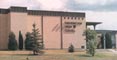 In May 1998, the department conducted a topographic survey of the Fredericton High School. This project was tackled by the students participating in GGE 2103 Survey Camp II primarily as a way to provide then with practical experience but also to give the high school an up-to-date plan of their facilities. After gathering the field data electronically, PC-based software was used to process the data and to plot the plan in the New Brunswick mapping coordinate system. A full resolution copy of the plan in Adobe Portable Document Format (PDF) was also produced.
It was felt that by showing an orthophoto map alongside the survey plan map, the students could better visualize what their high school looked like both as a "photograph" and as a map. The City of Fredericton provided us with an orthophoto of the Fredericton area. From this larger orthophoto, we zeroed in on the high school, and produced an orthophoto map of that much smaller school area. The CD ROM that the City provided contained the orthophoto, and a Service New Brunswick property layer.
This is the fourth time that a Fredericton school has been mapped by GGE students. In previous years, students have mapped the grounds of Garden Creek School, Albert Street Junior High School, and Montgomery Street Elementary School.
Click on the thumbnail image to fetch the PDF version of the plan, 1.1 MB. (If you don't have Adobe's Acrobat Reader, required to display PDFs, you can get it for free.)
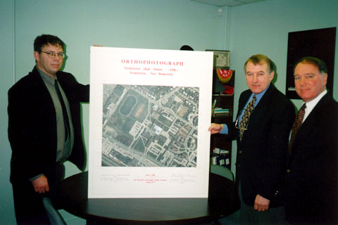 |
| Presentation of the final orthophoto map to the principal of Fredericton High School, Mr. Jim Thorburn. From left to right: Howard Biggar, Department geomatics technologist, Mr. Thorburn, and Dave Coleman, Department Chair. (Photo: Wendy Wells, 14 December 1998) |