

Leo Hayes Grade 12 Students Geocache at UNB
Buried treasure at UNB? Probably not. However, Shane Hoyt's Leo Hayes High School grade 12 geography class found caches - prize packages - using GPS receivers.
In late May 2003, GGE invited a group of Leo Hayes students to come to UNB to do a geocaching exercise on the UNB campus. The objective of this hands-on exercise was to teach the students how to use a GPS receiver for navigation.
The students were divided up into small groups and each group was given:
- a GPS Receiver;
- a list of 6 points on campus;
- a clue indicating the location of a cache.
The latitude/longitude values of the 6 points that the students had to navigate to were stored in the GPS receiver. In GPS terminology, points that are stored in the receiver are referred to as waypoints. Figure 1 shows the location of the waypoints. Figure 2 shows the route that one of the groups followed.
Each group then used the GPS receiver to navigate to their 6 waypoints. At each waypoint, there was a letter spray-painted on the ground. The groups then had to search for this letter and record its value. The letters at the 6 waypoints formed a code word.
A cache, consisting of various 'goodies', was located near each group's last waypoint. The cache actually was in an office in a UNB campus building located closest to the last waypoint. Each group's clue helped the group find the office containing the cache. In order to collect the cache, the group had to show an individual working in the office the group's code word.
Acknowledgements:
The Department of Geodesy and Geomatics Engineering would like to thank the following for their contribution to this exercise:
CARIS
City of Fredericton
Faculty of Engineering, UNB
UNB Bookstore
Bowl-a-Drome (Nashwaaksis)
Dairy Queen (Devon)
Jumbo Video (Nashwaaksis)
KFC (Nashwaaksis)
McDonald's (Nashwaaksis)
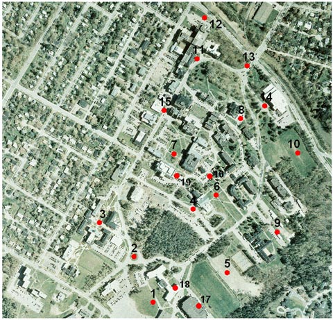 |
| Figure 1: Waypoint locations on UNB campus. |
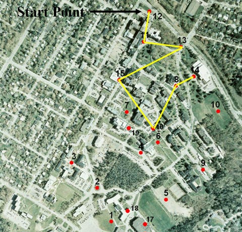 |
| Figure 2: A route followed by one of the groups. |