

GGE Alumnus Helps Map First Nation Lands
(Continued from here.)
Geomatics, a fairly recent addition to engineering nomenclature, is a discipline that encompasses the art, science, and technology involved in collecting and managing geographically referenced information. This information can come from a variety of sources such as orbiting satellites, air and sea-borne sensors, and ground-based instrumentation.
Geographical information, manipulated with high tech computer hardware and software, plays an important role in activities such as environmental studies; management of land and marine resources; monitoring of dams, oil fields, and mines for subsidence or movement; navigation of ships and aircraft; oceanography; real estate transactions; and tourism.
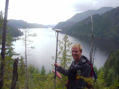
The work carried out by Rob and his colleagues made use of advanced GPS receivers (see photo). Such equipment is capable of positioning a point with an accuracy of a few centimetres and has become a standard tool with geomatics firms here in Canada and around the globe.
The completion of the Vancouver Island land transfer survey was celebrated with a feast hosted by the Kyuquot Checleset First Nation. A ceremonial survey marker was placed at a corner of the reserve next to the school so that it could be used to help teach children about the importance of the land. The marker replaces an old Dominion Land Survey Post dating from 1972.
For more on the land transfer survey, see “Post Cap Commemorates First Land Claims.”
 |