

Celebrating Geography Awareness Week and Geomatics Day, November 2002
Geography Awareness Week
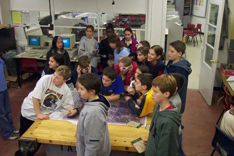
The National Geographic Society has sponsored Geography Awareness Week since 1987 to promote geographic literacy in schools, communities, and organizations, with a focus on the education of children.As part of Geography Awareness Week, volunteers from UNB (Department of Geodesy and Geomatics Engineering and UNB Libraries), Service New Brunswick (SNB), CARIS, and the City of Fredericton went to several schools in Fredericton and Boiestown to talk to students about geomatics. These schools included:
- Park Street Elementary School (Fredericton),
- Connaught Street Elementary School (Fredericton),
- Upper Miramichi Elementary School.
- Nashwaaksis Middle School,
- Albert Street Middle School (Fredericton), and
- Fredericton High School.
- introduced to the concept of working with maps;
- given the opportunity to view a selection of maps (e.g., satellite images of New Brunswick and Fredericton, topographic maps and street maps, etc.) and
- asked to perform a mapping exercise.
Park Street Elementary School
(Instructors: David Fraser and Teresa Tang, UNB GGE)
At Park Street School, the students in grades 4 and 5 created a map of their school. The students were given a base map (Figure 1) and were required to perform several tasks in order to complete the map. These tasks included:
- labelling several streets near the school,
- drawing symbols representing features on the Park Street School property (e.g., school, parking lot, soccer field, playground, and wading pool),
- adding a map title,
- creating a legend.
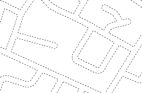 |
| Figure 1. Base Map of Park Street School |
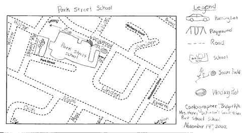 |
| Figure 2. Map of Park Street School |
Connaught Street Elementary School
(Instructors: David Fraser, UNB GGE and Julie Norton, SNB)
At Connaught Street School in Fredericton, the students in grades 4 and 5 created a map of an area surrounding theschool. The students were given a base map and were required to perform several tasks in order to complete the map. These tasks included:
- labelling several streets,
- drawing a house symbol (this symbol or picture represents where they live),
- drawing symbols for several places near Connaught Street School (e.g., fire station, Odell Park, Coliseum Rink, etc.),
- adding a map title,
- creating a legend.
 |
| Figure 3. Base Map of Connaught Street School and Surrounding Area |
Nashwaaksis Middle School, Albert Street Middle School, Fredericton High School, and Upper Miramichi Elementary School
Instructors: Elizabeth Hamilton and Siobhan Hanratty (UNB Libraries)
Support Team: Jeff Sharpe (CARIS), Julie Norton (SNB), Felix McCarthy (City of Fredericton) and David Fraser (UNB GGE)
Students in these schools were given the opportunity to design their own map for the webpages of their individual schools. The maps that the students designed may be viewed at http://www.lib.unb.ca/gddm/maps/gday/.
Examples of some of the comments made by middle school students concerning their mapping exercise
- We got to look at different types of maps. Elizabeth was a kind caring person. We liked her because she was very interesting and a fun person.
- Making the map on the computer to show people where Albert is. We liked it because it was FUN!!! Also, because it was interesting to look at all the different kinds of maps.
- I liked Elizabeth because she was peppy, and was right into it.
Albert Street Middle School
 |
| Dr. Y.C. Lee also gave the students at Albert Street School a presentation on GIS and mapping. |
Examples of the comments of some students in the middle schools on Dr. Lee's presentation
- Dr. Lee was very nice and funny. He gave us a tour of Hong Kong on his computer with virtual reality. He showed me my house by a satellite. We liked it because of the virtual reality tour of Hong Kong.
- I liked when Dr. Lee talked about the GPS system
- I liked it because it was very interesting, and very cool!!!!
Geomatics Day
On November 20, 2002, Geomatics Day was celebrated at the Wu Centre Auditorium on the campus of UNB. This event consisted of both a morning session and an evening session. A map gallery exhibit was also on display for both morning and evening sessions.Morning Session
The morning session focused on recognizing two of UNB's geomatics partners, namely, Service New Brunswick and CARIS. Some of the research projects currently underway at UNB and New Brunswick Community College-Moncton (NBCC-Moncton) were showcased.The following is an itinerary for the morning session:
- 10:00
- Welcome and introductions
J.Teskey, Director, UNB Libraries. - 10:05
- Geomatics partnerships, human capital and the future of New Brunswick
J.D. McLaughlin, President, UNB. - 10:15
- Honouring our partners: Presentations to Service New Brunswick and to CARIS.
- 10:20
- When you open the door to learning and research
- Kimberly Boucher (NBCC-Moncton)
- Samson Ng'ang'a (UNB Geodesy and Geomatics Engineering)
- Chengu Zhang (UNB Forestry and Environmental Engineering)
- Michael Sutherland (UNB Geodesy and Geomatics Engineering)
- 10:40
- Opening of Map Gallery, Wu Centre Foyer
Evening Session
The evening session focussed on geography in the community. During the evening session, Rob Lunn (GIS Manager for the City of Fredericton) gave a presentation on the use of geomatics in the City of Fredericton, and David Fraser and Elizabeth Hamilton showcased the activities performed in K-12 during Geography Awareness Week.Map Gallery
The Map Gallery included exhibits from- UNB Department of Geodesy and Geomatics Engineering
- UNB Ocean Mapping Group
- UNB Faculty of Forestry and Environmental Management
- UNB Department of Geology
- UNB Libraries
- City of Fredericton
- Service New Brunswick
- CFB Gagetown
- CARIS
- PCI Geomatics
- Connaught Street Elementary School
- Park Street Elementary School
Click here to read UNB's news release on the activities.